Google includes Romania in Street View

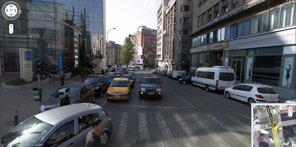
 Google has launched the Street View application in Romania, available for eight cities in the country, among which Bucharest, Brasov, Oradea, Timisoara, Cluj, Sibiu and Constanta. The application covers in total 6,000 km of the Romanian territory.
Romania is the 27th country to be included in the Street View service, which allows users to see 3D street images of their location of choice on Google Maps. Car license plates and people's face are blurred. Street View is also available on the Google Earth application.
Street View was launched in 2007, initially just in five US cities. Street View cars have special cameras that take photographs as they drive down public streets. Once the photographs have been taken they go through computer processing to make them ready for use on Google Maps. The imagery isn't real-time and it usually takes several months from when the photograph is taken until it appears on Google Maps.
Check out images from Bucharest on Google Maps here.


